Mar 18 Canyon de Chelly

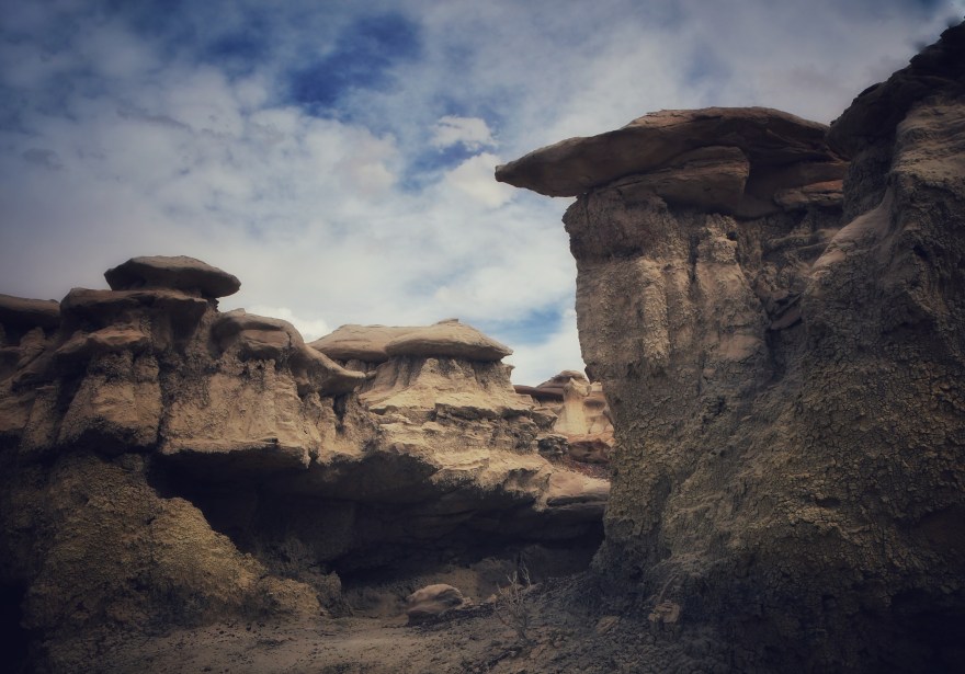
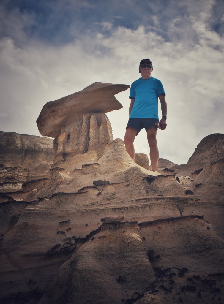
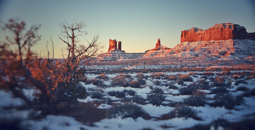
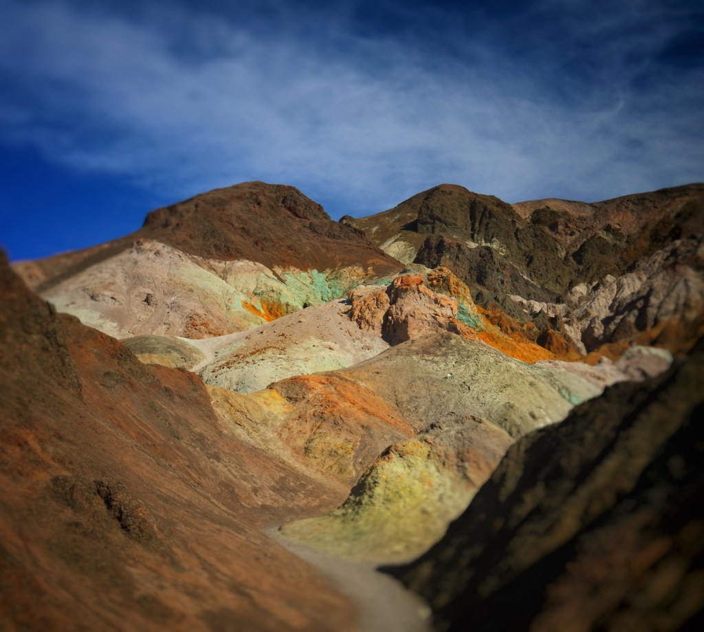
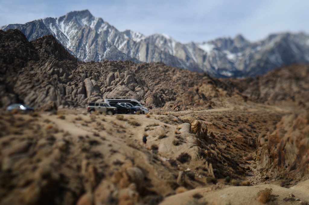
We arrived at the Cottonwood Campground outside of Canyon de Chelly – it was seriously windy when we left Farmington – gusts up to 55 miles per hour and then came the dust storms.  This we endured for about two hours and when we turned south in Arizona the winds died down and we entered a landscape much like Monument Valley meets the Canyonlands.  We stopped in Rock Point, still in Navajo territory, to get something to drink. As we drove through we were amazed at the formations in this otherwise nondescript area.  I suppose because it was still the Navajo Nation and they respectfully and quietly walk in beauty in their surroundings not wanting invaders to disrupt the balance.  Many of the homes are built in the traditional hogan shape – octagonal, some with modern doors on them – in honor of their traditions while flexing to modernization. There are no McMansions here, mostly converted double wides, some with corrals and livestock. 

We entered Chinle as the wind picked up again and stopped at Basha Dine’ – the Navajo version of Safeway – there are no grocery chain stores here – just the usual fast food joints.  

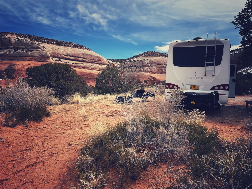
We arrived at the nearly deserted campground and found a sunny site.  After so many days of getting up early and hiking to catch the sunrises it was nice that we were going to be stationary for a few days.  

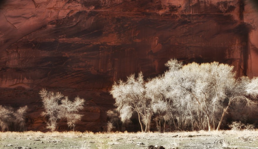
It’s still considered winter here and the trees are bare and I’m sure it’s prettier in the spring and summer as we are surrounded by cottonwoods.  The campground has flush toilets and sinks which is very convenient for a campground.   

As the day went on the campground started to fill up – another Leisure Travel Unity arrived and we had a nice chat!  The first one we’ve encountered at a site.  

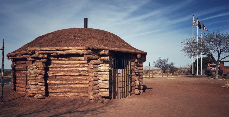
The next day we had a leisurely day walking up to the Visitor Center and talking to the local ranger who gave us tour of the hogan they have on site.  It was great to be in one that was made out of traditional materials with its east facing entrance.  

Traditional Navajo Hogan

We booked a Jeep tour of the canyon (tsegi in Navajo) with Bobbie VanWinkle who was born in Spider Rock since you can only go into the canyon proper with a guide.  

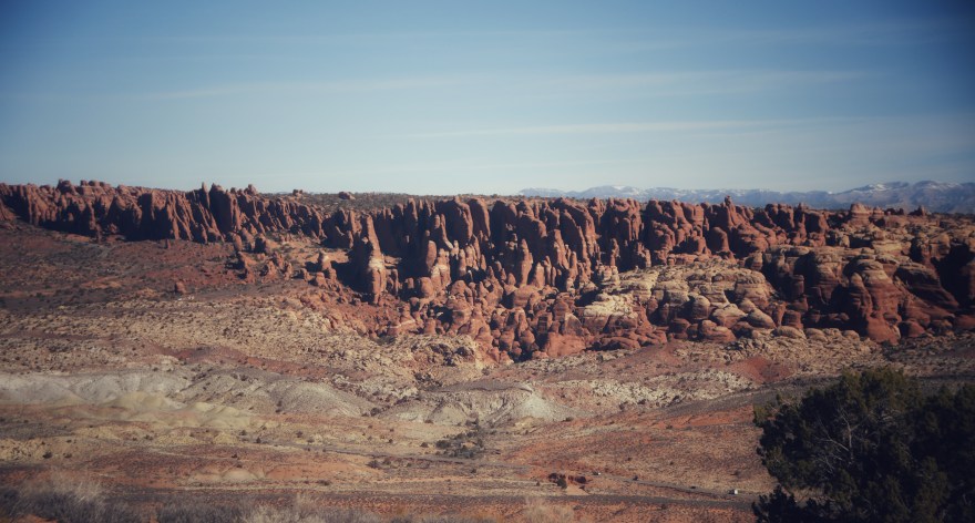
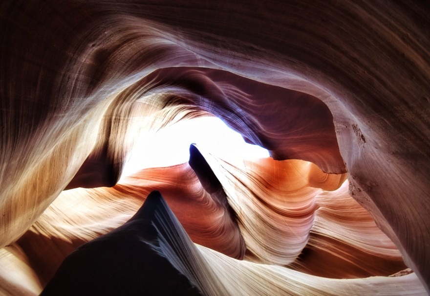
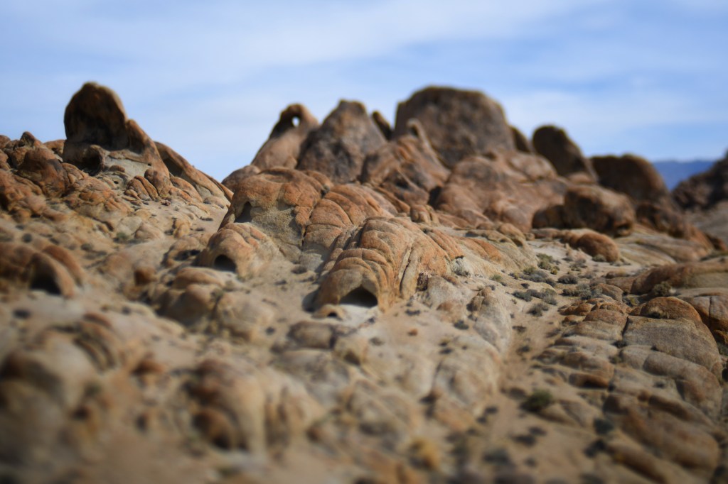
Despite the Dutch name, Bobbie is Navajo and explained there are many mixed race families who live there, but you have to be married within a clan to reside in the valley. The ride was definitely four wheel drive terrain; through washes and up muddy inclines.  The towering rock faces did not disappoint – they looked as though they had been cut out by a carving knife; they were so sheer and flat with reds and maroon veins washing down the sides.  The floor is peppered with cottonwoods though they are not indigenous and the canyon should be populated by pinion and juniper much like the canyonlands.  

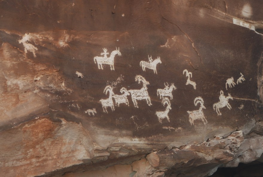
We quickly came across the petroglyph and paintings that were done in some cases a thousand years ago by the Pueblo tribes.  They are now Hopi and what the Navajo refer to as the Anasazi – the Ancient Ones.  

Kiva recessed in the cliffs

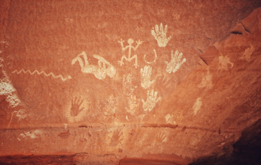
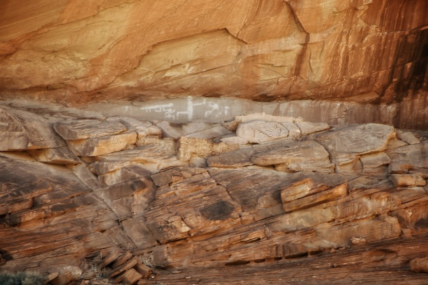
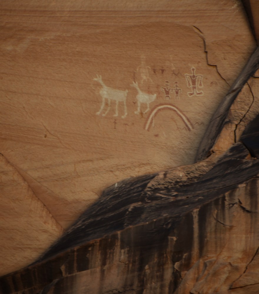
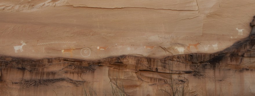
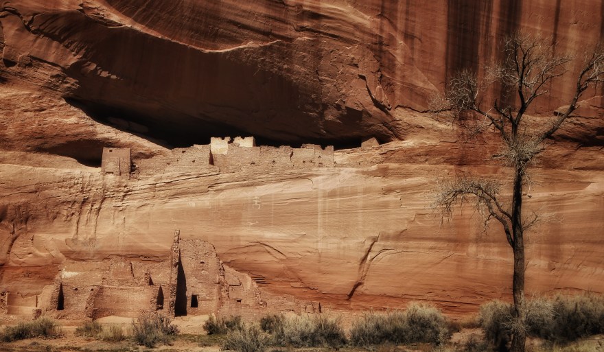
We stood witness to these ancient impressions that had survived the elements for centuries.  Then the ruins surfaced on the cliff sides – the kivas and food storage with more rock paintings protected by the sheer mesa cliffs. These dwellings are scattered throughout the canyon, most inaccessible except for the archeologists who frequent the area.  The canyon itself has worn away leaving the dwellings out of climbing distance.  The most accessible are the White House and Antelope ruins that are closer to the valley floor and fenced off to keep the usual miscreants from vandalizing the sites.  The White House ruins are named due to the white plaster that reflects the sun.  We noticed graffiti carved into the face of the ruins and upon closer inspection, one of the carvings was dated 1873!  So it was the earlier settlers defacing the ruins….

As we meandered our way through the mesa, I pondered the generations of seedlings now germinating, the shifting landscape providing glimpses into lifestyles still farmed by the Navajo in the same manner they have been doing for hundreds of years; wool still spun from weathered hands that tend the sheep.  The tribes could exist now as they had a millennia ago – clinging to the lost art of the land.  

The canyon remains a pristine outback not easily disabused by modernization – the vendor at the Antelope Ruins has no cell service and works on faith that you will Venmo her the money for the pottery you just bought. 

Stubborn to evolve or worried they could lose the thread of culture and place they have fought so hard to preserve?

A perfect day mingling with the ancients – under the same blue skies and mesas they embraced so long ago.  

Mar 16 – Bisti De-Na-Zin Badlands

When we initially crossed into New Mexico I felt like I was in an alien landscape.  It’s quite barren save for Shiprock which in it’s stately demeanor says “untouchable,” and means it. We got settled in our RV Park on the outskirts of Farmington which is one of the larger cities in New Mexico, so we were able to stock up on some necessary items.  While I’m not a fan of Walmart due to their employment practices, I need to get over it as they are the only consistent chain where we can get what we need for BigB.  

We had a pleasantly quiet morning along with a hot shower and set out to the Bisti Badlands.  

Bisti is off a service road about 35 miles south of Farmington.  To get there we had to drive a three mile gravelled road to the BLM parking area.   While not full of potholes, it was a bit washerboard and we could only go five miles per hour – the going was rough.  Even though it took twenty minutes it seemed like forever.  People haul their RVs down that road all the time but it isn’t much fun.

When we reached the parking there was nothing to see except desert and some distant mounds. The lot was fairly full with another RV parked there – we couldn’t see any signs of life though. 

There really isn’t a trail to the hoodoo’s or what I view as stone mutations.  You follow a wash but there are cataracts of washes so it isn’t entirely clear; if you see other people you follow on faith but they might not know where they are going either.  We stumbled across the first “forest” which turned out to be a fun playground of exploration.  

The hoodoos look fragile, but are actually quite solid having been molded by a millennia of sun and wind.  They are formed from sandstone, but not really petrified, except for the fallen trees that date back to the Stone Age. It is here where they discovered the “Bisti Beast,” a smaller version of T Rex.  

If these forms were whipped together by spirits or aliens we couldn’t find them – they did a good job of hiding in the many nooks and crannies: It’s a place that equally shifts and is frozen in time when no one is looking – a space/time continuum thing.

The table tops are even more fantastical as they somehow remain propped up by one of the spirits that refuses to reveal itself. 

That’s Bob – not to be confused with the resident spirits

Walking a mile further we found larger hoodoos and also a bit of a debris field of curious formations created by a lot of mischief.  

Otherwise the landscape is desolate and reminded me of those westerns where people slowly die of thirst as they wander nowhere – hence the name ”badlands” I suppose. Add the wind that started to whip up and the clouds on the horizon, we decided to turn back.  It’s always a great workout fighting headwind on a hike – but not the “Lady in the Wind” experience I had hoped for. 

We had a nice afternoon tea in BigB to regroup and warm up.

Once back on the main highway, and after checking whether our teeth were still intact from the service road maze, we realized there were similar formations on the side of the road.  I suspect what we had just hiked was simply a tease designed by those shape-shifting spirits who have bargained with the folks at BLM to toy with us humans. 

Mar 15 – Moab to Shiprock

Warning – this post is more of a rant!

We had been to Moab nearly ten years ago and had missed the Delicate Arch as it was closed due to severe road damage.  This time was stayed at the KOA in Moab and scheduled to bug out at 6:00 to beat the crowds.  The Arches entrance is open 24/7 and we drove right through followed by a few cars.  The starry skies were interrupted by foreboding towers as we snaked through the legendary landscape in the twilight.  We reached the parking area and were thankful that it was only partially full.  It was in the 30’s and we had a 1.5 mile hike to get to the arch for sunrise.  I have Renauds (really cold fingers) and had my USB hand warmer in my pocket which proved to be invaluable. 

We did not realize what an uphill slog this would be and at elevation it proved to be quite a work out.  Bob went ahead as he has better capacity than me to get up the escarpment.  I somehow passed people and found myself alone; some of the poles were missing the trail signs so I took up tracking footprints in what sand there was.  

It’s not a place accommodating to people who fear heights or have physical impairments.  After nearly an hour I turned the corner and was blinded by the sun; I felt my way along the narrow trail and reached the viewpoint.  There were at least a hundred people sitting along the rocky outcrop and people were already leaving. The problem was the sun comes up over the back of the butte and takes a while to light up the arch.  More people came in and many climbed down to the arch itself for look-at-me photo ops.

This is where I had a problem:  It’s dangerous to be climbing around the arch and then people kept going out there for selfies and photo ops to the point that those at the viewpoint started yelling at the people to stop so the rest of us could enjoy and photograph from a respectable distance.  You can easily get a good picture from the viewpoint including the obsessive me, me, me selfies.  

In my opinion, while they are starting to restrict access to the parks anyway, I think they should fence off access to the arch itself – there is no reason to climb on it or deface it.  People notoriously deface monuments to the point the Navajo started restricting bags into the slot canyons as they caught a couple chisling away pieces of the canyon for souvenirs. 

“Bilagaana” is the term the Navajo use for white man or white man ways and the accompanying greed and egos that create imbalance – this concept now extends to any race that does not respect the boundaries of the land where they are visitors.  

We are all just passing through, no one is going to remember most of us in a hundred years but they will remember all the crap we leave.

I got my token I-was-there shot of the arch though there was no moment of zen to listen to the wind and take in the landscape or remind me of a profound moment; instead there was the scolding of children, the insistence on photographing themselves instead of really appreciating the arch, the cavalier climbing along the rock face and in one case almost slipping off, topped off with an overbearing tour guide who wouldn’t stop talking about himself…and it was cold.

My universe shrunk and I felt small – but it wasn’t because I was assessing my existence against a vast galaxy of stars. 

Delicate Arch

We decided to do this trip because the overcrowding is such that even though we visit, we may not really get a chance to truly enjoy these monumental landscapes for much longer. 

We hiked back down and on occasion were blocked by people who stood at the narrow passages with little concept that other people were trying to get by.  

When we got to the bottom we broke off to see the petroglyphs that certainly didn’t garner as much attention or selfies.  

No doubt carved by an Ute during a moment of zen

When we reached the parking lot around 9:00 it was full; people parking in RV spaces where they weren’t supposed to, people driving the wrong way in the lot trying to hijack available spots as they opened up (I almost got run over by an SUV). There was a line at the toilets.  It was like being in a shopping mall at Christmas.  

We stopped off for breakfast at the viewpoint to the Devil’s Garden where it was clear and beautiful and only a few other people.  While our experience at Delicate Arch was a disappointment – the landscape was not; another incredible palette conjured up by an imagination I can only sell my soul to the devil to possess. 

Devil’s Garden for breakfast

We stopped by the visitor center for our fridge magnet. Unfortunately the magnet board came unhinged from the wall and we’re having to come up a way to secure it better.

BigB copping a tan at Moab Visitor Center

We left waving to the mile long line of cars trying to get into the park. On the way we passed by Wilson’s Arch and of course Wilson was excited.

We headed out over the high altitude farmlands of Colorado to the Four Corners, then onto Farmington by way of Shiprock.  We had gone through four states!

Bob was wondering why there wasn’t more signage or accessibility to the rock itself; because it is sacred and we are back in Navajo country – it is an abomination to climb or deface it as it would risk bad mojo to the Dine’ so they don’t want Bilagaana coming in and messing things up. Lord knows rock climbing associations have been trying for years to gain access. We went down a paved service road to get closer and turned onto a dirt roundabout for a better view.

There was garbage everywhere; empty bottles and cans against the backdrop of a sacred monument.  

I rest my case. 

Shiprock – the Winged Rock

Mar 12-14 Needles Outlook, Canyonlands

We headed for the high altitude Canyonlands Rim Recreation area, home of the Needles Outlook and Windwhistle Campground.  We explored the Outlook with it’s sheer precipes akin to the Grand Canyon, though the lighting was a bit harsh and the landscape was less defined as a result.  We decided viewing would be better in the morning.  

We went off the grid for a few days with barely any signal and definitely no Wi-Fi.  We are so attached to our devices that we wondered how we coped back in the day when we camped and had no signal.  That’s where having a good book, editing photos and journaling really come into play. 

On the way back from the outlook we saw a volleyball on the side of the road, that like Dave, must have done a runner.  Realize that there is no trash on the sides of the roads here – it’s completely pristine so it really stood out.  We picked it up and it turned out to be a Wilson!  So Wilson became part of the family to keep Grogu company. I’m sure the family misses Wilson but he has found a good home so we are sending out positive vibes.

Welcome Wilson!!

We went to the campground with it’s smooth rounded sandstone backdrop and found a level site.  There are no sharp edges here as if the wind decided it wanted to define a different pallet from other areas of the Southwest.  The shaded areas were still protecting the snow that was slowly melting as the pressure system that had been plaguing us finally decided to move on. There were only two other campers around out of the fifteen sites and even they eventually siphoned off leaving Bob and I alone in this little slice of Paradise. The quiet is what I craved after all the stresses of noise pollution, and I sat and contemplated this level of emptiness thinking my surroundings had done fine without me for thousands of years.  There were occasional birds and the tracks of deer but otherwise you could meditate virtually undisturbed for quite a while.  

The emptiness is helping me reboot and I’m re-wiring myself to slow down.  The physical problems (knots) with the shoulders and my arm are finally subsiding.  I’m starting to lose track of the days which is both a curse and blessing.

The weather remained clear though there was the occasional gusts of wind.  When the wind died down and the sun came out it was warm and pleasant. 

The morning jaunt along the Needles Outlook turned out to be the best bet.  Though it was thirty degrees out with the wind making it even chillier, it soon heated up.  As we we are a contained unit we sat in solitary bliss and had our coffee and breakfast against the magnificent backdrop of the Canyonlands without another soul around. We switched on the local radio station which was playing Native American music.  Otherwise all you could hear was the wind and the indian chants drifting faintly from the RV.

For a moment I felt like the “Lady in the Wind.”  There was no rush, just nature and all the beauty that erupted from the vast Canyonlands of Utah for those who wish to partake.  

The Needles – Canyonland

Later that day we hiked the nature trail around the campground and learned about the fauna and flora; the twisted juniper and their edible berries, the sage and other plants used for medicinal purposes by the Navajo.  

BLM has done an incredible job of installing and maintaining this area considering how little it appears to be used. 

Otherwise we relaxed, enjoying the view until the wind kicked up.  Bob dug out the barbecue and we had “Willamette Valley” chicken breasts wrapped in bacon (from the local market no less) with wild rice and steamed carrots topped off with a nice Warr King Rose’ from by brother and frozen Mochi for desert. This was the first major meal we cooked in the RV while being on the road.  Glamping at it’s best!  

It was Sunday and four other campers showed up which we found interesting as the weekend was winding down.  They settled in, one was strumming on the guitar that drifted through the canyon along with the smell of campfires.  

We saw a weather system coming in and heard rain on our roof later that night but woke up to the sun and warm coming over the indelible sandstone features of the Moab area.  

Mar 9-12 Monument Valley

The weather system that continued to blow through the Southwest followed us to Monument Valley and we found ourselves snowed in the first day with the visitor center closed; it was basically a white out and we were stuck indoors with limited wi fi.  It’s rare thing to see Monument Valley in the snow; we had been here before nearly ten years ago, though seeing it again after so long brought the grandeur of the place back into the mind’s eye. 

By late morning, the buttes were hugged by cloud cover that dissipated as the day went on, releasing blue sky that encouraged the melt.  As soon as the roads became passable we decided to visit the Goulding Trading Post and the flurries picked up again as we made our way back to the RV park.  We extended our stay an extra day as we had a horseback ride booked but that wasn’t going to happen so we rescheduled. 

Based on weather forecasts during our planning phase, we hadn’t planned to be in such frigid temps.  We had picked up antifreeze in Page as a backup plan and were certainly were glad we did.  We poured antifreeze in the tanks and set a warming lamp by the fresh water and water pump but despite our efforts, including running faucets in the middle of the night, our pipes feeding the freshwater froze; the temperatures plunged into the teens. In the morning we turned the rig around to get the now blazing sun against the water intake side to heat things up.  

We eventually ventured to the MV Visitor Center which was virtually deserted and poked around the shop and picked up a Navajo medicine man carving, our standard magnet, and a book on the Dine’ as I am forever fascinated by the culture.  

When we got back to BigB we coaxed the water through the pipes and were relieved when they started flowing again.  

We decided to drive up to Mexican Hat and encountered the site immortalized by Forrest Gump – the scene where he’s running through Monument Valley and decided he didn’t want to run anymore; people were standing in the road trying to get selfies, even though you’re not supposed to stop in the road they of course slowed down traffic.  It was the wrong time of day to get a photograph anyway.  

We decided to lunch in Mexican Hat at the same restaurant we ate at nearly ten years before.  Another Navajo Taco..

We got back for our scheduled horseback ride.  It had gotten up into the low forties and was sunny.  The KOA (a chain of RV parks) we were staying at had a horse stable attached to it.  We met Guy who was the older Navajo gentleman in charge along with Priscilla and Harrison.  Harrison was set to be our guide for the day.  He was 26 years old and his family owned a large chunk of land in the valley.  He was a mechanic who also specialized in training horses.  

We set out to ride along the mesa that skirted the buttes.  

It was great having a conversation with Harrison – I was more interested in what he had to say than the ride as the day was getting increasingly cold and was starting to chill my bones.  

The struggle with the younger Navajo generation as they want to see progress but the elders are concerned that they will go the “white man” way. Meaning they would lose their balance, and when this happens they suffer afflications that need to be healed by their medicine men and ceremonies.  I had noticed the large branches stacked up like tee pees and suspect those were the sweat lodges they used for purification and healing.  

There is also a conundrum of availability of basic staples closer to them instead of having to drive all the way to Page to get their shopping done at reasonable prices.  If they shop at Goulding they are paying exhorbinant prices for basic goods.  

Navajo country is such a spiritual and profound place and it could easily be overrun with opportunistic developers destroying what is dearly sacred (they have already experienced this creep with the Uranium mining). We rode through the ancient mesas, their recesses still covered in spits of snow.  

We finished the day feeding the horses carrots and I was glad to stretch my aching knees and looking forward to a glass of wine. Fortunately BigB wasn’t far away, set in the backdrop of the valley.  

I’m obviously feeling the bite from the cold

As I watched the day fade, the pink hues of twilight softened the deep magenta sandstone, the brushstokes of evening blended with the landscape growing deeper as the stars began to rise.  

It’s fascinating to think that this place used to be oceanic and these buttes were part of a watery underworld.  With the way things are going it might once again reclaim that heritage.  

This landscape is not a national park, it is part of the Navajo Nation. The massive red buttes stand guard in a sacred bond; a testimony to the endurance and beauty of the the Dine’. 

Mar 9 – Slot Canyons, Antelope Valley

The warm and welcoming curvatures of Antelope Valley’s Slot Canyons inspire you with a sensuality molded through centuries of monsoonal heat and floods.  The Navajo refer to the formations in the region as Navajo Sandstone; the reddish-orange volcanic sand mixed with water and baked by the sun is what they Navajo also use to build their tradition homes known as hogans.  

While part of the Navajo Nation, these canyons were never inhabited by the tribe due to the violent flash floods; species such as snakes and scorpions are some of the unfortunate victims that get swept into the slots.  Local guides collect them as they clear the canyons of the debris; diamond backs that have been stranded in the upper reaches have been known known to drop onto the canyon floor.  

One of the more striking formations is the “Lady in the Wind.”  She is nature’s version of Michaelangelo’s Slaves; figures emerging from the marble that are housed at the entrance of the Academia in Florence where his famous statue of David resides. But the Lady in the Wind is not part of any human construct; she is force of nature, forged from elemental earth and water: The Lady becomes one with the storm.  

The Lady in the Wind

The fluctuating light plays with the sloping crescents and arches throwing shades of red, yellow, orange while refracting hints of bluish black on some of the sharper edges.  

The Navajo insist on wearing masks; the tribe took a terrible hit during the pandemic so no smiling faces in the photo which is a minor sacrifice in respect for the Dine’.

Mar 5-7 The Grand Canyon

After a rough weather day of being pummeled by sleet, buffeting wind, and massive tumbleweeds that we thought would eat our rig, we reached the Grand Canyon Trailer Village worrying about our pipes freezing as the snow began to fall.  We hooked up the utility lamp to heat up the fresh water tank area and stuffed towels in the bay.  We ran the taps in the middle of the night – so far so good.  By morning we awoke to a carpet of snow and for a moment our worries were swept away by the crystal reflections that accompanied the melt as the sun shot through the blue sky.  

Brrrr!!

The park does a great job with the shuttle service and we walked from our site to the bus stop arriving at Mather Point within a few minutes.  My mind and heart are simply not big enough to embrace this epic visage of a place.  It stuns you into submission at every turn. The cold and the infinite landscape dissipated the usual burn of a long walk. 

The trees were covered with a dusting of snow and you would see on occasion an old and twisted juniper standing guard; a rebel against the elements.  

The conditions were slushy with a dash of ice and if you weren’t careful you could have a nasty spill.  I’m surprised more people don’t actually plummet to their deaths with their cavalier selfies at the cliff’s edge. We stuck with safer options.

Sadly, our dear companion Dave-the-Minion did a runner on the trail.  We tried to find him but came up empty handed with no response from lost and found yet.  We can only hope he has been retrieved by a loving family.  We’ve had him for years and he has been with us on so many journeys.  I hope he didn’t take offense to no longer being the “only one” since we brought baby Yoda (Grogu) into the fold.  

Dave we are going to miss you:(

Cold, tired and equally exhilarated, we had a nice late lunch at the El Tovar Lodge dining room, I had a Navajo Taco which was really satisfying with Indian bread as a base. We picked up a few souvenirs along the way including a book on Navajo rugs as I want to understand the underlying meaning of the designs.  

I managed to squeeze in a few pictures on my dad’s 1977 Pentax; I will be taking BW 35mm Ilford film images as we move around the national parks; I hope to capture those places he never got a chance to get to.  It will be exciting to see the end result! 

We woke up to freezing temps with worse weather on the way.  We decided to go to Yaki point which was spectacular with the new snow and the shifting cotton ball clouds, but we could see the weather system coming in and got caught in it on our way to the visitor center from the Pipe Creek Vista.  It was horizontal snow pelting us as we made our way back to Big B.  We decided the weather was too harsh and socked in to enjoy the rest of our stay so packed up and meandered are way carefully through the park roads.

We left by way of Williams and Flagstaff and drove in blizzard-like conditions along Route 66 until we turned off to Page.  The weather finally broke and ice started peeling off the rig.  The landscape along the Vermillion Cliffs National Monument made for an eye-popping end of the day.  The sky was clear and we thawed out at the Lake Powell Campground – winding down with a classic southwest sunset. Tomorrow will be a rest day and a chance to give the rig a desperately needed clean.

Mar 4 – Death Valley – Life Below Sea Level

The Mesquite Sand Dunes – it was hot

Forged from massive tectonic disruptions, most of Death Valley sprawls like the crust from a loaf of rustic multigrain bread (think Dave’s Killer bread), it’s design carved by flash floods vs the smooth, endless sands of Lawrence of Arabia lore (save for the occasional dunes). What stands out are the mineral deposits of the Artist’s Palette off of Badwater Basin road: Chloride and varying mineral deposits mix with rarified storms to create a swirl of watercolor that seems displaced in such a stark landscape like some sort of cruel tease. 

The beauty of a cruel tease

Further down Badwater Basin road  is well – Badwater Basin; a salt flat fed by an equally salty acquifer.  

Badwater Basin – lowest point in North America at 282 feet below sea level

This is a place of mirages and cauldrons, blinding light and mineral nightmares that burst at the seams more so than any other place on the planet. 

We did not encounter any skeletal remains like you see on the post cards because most animals, save humans, know this isn’t exactly paradise.  

We drove through endless terrain with no cell signal on our way to Kingman, AZ.   You drive through here on faith that you don’t break down because there wasn’t a lot of traffic heading our way and no reception that we could rely on. 

We will be going from below sea level to 7000 feet at the Grand Canyon with the possibility of snow.  Bracing for the extremes. 

Feb 28 – Mar 3 Alabama Hills by way of Morro Bay

We bid farewell to Santa Rosa but didn’t go across the Golden Gate and headed for San Jose instead to connect with the 101.  It took us a couple of hours to get through the Bay Area traffic and were glad when the 101 finally narrowed.  Otherwise the road was pretty non-descript except for the endless miles of agriculture and vines – this must be a place that supplies grapes to places like Gallo (I’m making that assumption as it looks like a mass production vs carefully cultivated vintages).  We stopped for lunch in Monterey Bay (whipping up a salad and tea in the RV) in the Fort Ord area.  Another beautiful day – we have been so lucky.  We reached Morro Bay about 4:30 – it was warm and we are practically on the beach with a massive haystack rock right on the ocean known as Morro Rock.  It’s really quite something.  I put on my sandals, finally releasing my feet from their winter bondage.  I had to peel down into a blouse as the weather was in the high 70’s; I couldn’t remember the last time I was in warm weather like that! We went for a sunset walk and then sat by the fire with a shot of whiskey – the temperature dropped quickly so we cozied back into the RV to read and further reflect on the day.   

Amazing view from our spot at the RV park

We woke up to a view of the beach and Morro Rock.  As we had a long drive that day to Alabama Hills in Lone Pine we got it together early.  We met up with one of Bob’s friends from his Adidas days and had a nice walk along the waterfront and paused to watch the sea otters lounging by the shore.  It got warm quickly and I changed into my fair weather clothing.  We drove the route to Bakersfield through endless commercial wineries and agricultural area. We heard on the radio that San Luis Obispo had the highest gas prices in the country as we realized when we took a few sips at $5.29 per gallon until we could find cheaper prices!  We stopped off for (cheaper) gas on Highway 46 where the fatal crash that killed James Dean is memorialized.   California had just lifted the mask mandate and it appeared most everyone got the message.  The station had a large shop with “frogs balls” and Route 66 memorabilia even though we weren’t on Route 66…

We stopped in a ghost town called Bodfish and they had a USS Arizona memorial of all things with actual artifacts from the ship!  I will be there in April to commemorate my father’s service so was rather excited to discover this gem in the middle of nowhere.  I don’t know what possessed such a remote location to put these artifacts on display – which made it all the more impressive.  

We reached the Eastern Sierra Scenic Byway with it’s basalt rocks tossed all over the valley and cones that could easily be mistaken for recent volcanic activity.  It was barren and we couldn’t figure out what people did for a living outside of working at the power plants or China Lake.  Then the Sierra’s started peaking out as we neared Lone Pine and we got excited when we spotted the first outcroppings of the Alabama Hills while driving along Whitney Portal Road.

We paid $8.00 per night for the Tuttle Creek Campground.  There were not that many people around us.  The place is clean and well organized with pit toilets and a camp host.  The lovely creek was behind us and was the only sound as we watched the sun go down behind the Sierra’s.  We are in a new moon phase and I got up around 2:00 a.m. to see if I could see the Milky Way but there was some cloud cover on the horizon. Otherwise the night skies were clear and I was blessed with a shooting star.  

Night skies at Alabama Hills!

Then we woke up to this view.  

Too cold to get out of bed though

What I love about BigB is we can switch on the 12v heater and as soon as the sun comes up the battery starts charging up again from our solar panels. We had filled up our water tank and have our LP for coffee, heat and the refrigerator.  We are self-contained in this euphoric glamping world.  When dry camping (or boondocking) we read and journal.  I can work on my devices (including the internet if we have signal) and juice them up as needed with the inverter; our solar panels keep us well supplied. After two long days of driving we we are in no rush and can poke around the hills at our leisure #lovinthervlife 

We are at an elevation of 5000 feet and the hills themselves are in walking distance though the walk back turned out to be a couple of miles of uphill terrain and it felt hot even though it was in the 70’s.  The sky was a brilliant blue at this elevation and the sun was equally intense.  I thought about the animals the inhabit the region and their solitude.  

This place and time was like a dream come true, though no, it was really the beginning of a transcendence into a different reality.  The creek by our campsite paid no heed to my toes and ears, yet soothed my ears; the sun was indifferent to my skin – I felt bathed in my entirety by the high Sierra despite the burn.  

It was quiet, solitary much like the Redwoods but more distant, higher with thinner air and the absence of shelter except amongst the towering formations rooted beyond my imagination.  All this while Russia lays siege to the Ukraine, we weep and pray for the people of the Ukraine; we wish them the same solitude, instead of the ragged remnants of what was normal, brought by unnatural moving thunder.  

Inhaling the smoke of our fire, we recede as the sun sets behind the mountain range, exacting and reliable, we can always count on the horizons as if they say at least some things change but are not chaotic.  

We finished the day with one of the oranges from Sonoma – a mixture of citrus and smoke like the many fine wines of the region. 

Day’s End

Alabama Hills last day.

We stopped by the Gunga Din day use area on our way out of the hills. It has a large plaque dedicated to the movie that was filmed along the trail. Every angle of these formations connects in a different way and beckons exploration.  It’s not a long trail unless you go want to go bouldering – then you have infinity at your disposal.  

The Gunga Din Trail

We stopped by the rather touristed Mobius Arch with Mt. Whitney perfectly framed in its portal; was it a chance display by nature or just how we humans interpret it?   The trail was nicely laid out with more formations but these ones had caves honed from the sides and the backdrop of Mt. Whitney was clearer.  The rocks were rounded as if smoothed by an artisan well versed in geometry.  

The boys had to be in the shots of course as they rather liked the Alabama Hills.

We overnighted in Death Valley at Stovepipe (it’s a parking lot with about as much appeal as its name…. complete with generators going).  it was 85 degrees and we were thankful we had decided to stay in Alabama Hills an extra night instead of Death Valley.  It was warm enough so we turned on the generator for a little while and the AC to cool the cabin down.  It was noisy but it worked.  

We have certainly had the extremes – with Mt. Whitney being the highest point and Death Valley being the lowest – it is a bit like the circle of life

Feb 24 – 27 Sonoma and SFO

We bugged out on Thursday and stopped by the Redwoods Founders Grove on the way out. This is an astoundingly ancient place that predates Christ and feels like seeds sprung from something primordial.  The fallen trees must have created their own thunder when they fell. The sun crept through just enough to light the way in a lovely diffusion; the paths were lined with years of needles forming a carpeted trail through the woods.  Otherwise the grove was left to its natural state – I imagined it hadn’t changed much over the last several hundred years. There is a lot of wisdom there – but they speak a different language from modern civilization; we dare to listen but not to learn. 

We continued down the coast to Mendocino County and it’s folk-art rolling green hills dotted with vineyards and arrived in Santa Rosa at our friend’s house (Peter Testie) where we will stay for the next three days.

On Friday I went on a tour with Peter of several Sonoma wineries.  It was a beautiful day lounging in the sun tasting wine.  We found an excellent wine at Hanna winery called Alchimie that is a mix including grapes from rare vines of which there are only an acre in France, two acres in Australia and one acre owned by Hanna vineyards in Sonoma.  I picked up another nice Pinot and Rose’. 

“Wine is sunlight, held together by water”

Galileo

We laid low on Saturday getting the RV organized and cleaned up from beach and forest debris – you almost don’t want to sweep it away as it’s all part of the memories but you can’t get too nostalgic about dirt.  

On Sunday we headed to San Francisco – it was a stunner of a morning and we stopped on the south side of the Golden Gate Bridge and walked the trails to the Battery Park viewpoints.  My father had come through San Francisco during WWII while serving in the Navy – the old bunkers were still there – decommissioned and riddled with graffiti.  

It has a great view of the bridge and the bay and all the shipping traffic.  

Golden Gate from Battery Park

We parked at Ghirardelli Square, had coffee and picked up chocolate and trinkets before heading out to the wharf.  There is a great view of Alcatraz from the end of Pier 39.   The pier was fun and kitschy with all the smells, eateries and vendors with the carousel at the end.  

One way to get off Alcatraz!

We were set on getting some Dim Sum in Chinatown and went to the Imperial Palace (Peter’s recommendation).  It’s located off Washington and it mostly caters to the locals.  It was busy and noisy and reminded me of being back in China.  We were the only white people in the whole joint.  We had pork steamed buns, fish dumplings, wontons, fried rice and a pineapple custard steamed bun for dessert.  It was excellent.  If you are looking for the typical western intimate atmosphere this is not the place – it’s authentic – not the Westernized idea of what a Chinese restaurant should be.

Imperial Palace – Chinatown

After getting our fill of Cantonese delights, we left to find the Dragon Gate, passing the legendary cable cars that were practically empty.  Unfortunately the street trolleys along the wharf were not running – probably because we were off season.  We may catch them up on our way back up to Portland.  We poked around the shops, taking in the atmosphere then headed back to the Ghirardelli square where we shared one of their sundaes and then drove up to the famous winding Lombard street.  I don’t know how all those structures were ever built on those steep hills.  The end of another fantastic day in the Bay Area – the weather was perfect and the sites did not disappoint!